The Old Mills of Heywood: C-E
 |
| You can also find information about the following mills on this interactive map. |
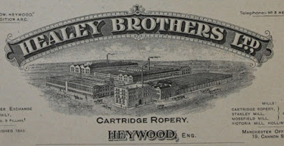
Cartridge Ropery
RopeBrunswick Street
1843: Established by William Healey.
1874: Became Healey Bros. when his sons William, Robert and Jehu took over the business. They manufactured many types of rope including mill drive ropes, and a rope walk stretched from Cartridge Ropery through the grounds of Brooklands, owned by the Healeys, until 1940.
1888 directory: Healey Brothers (manufacturers of all kinds of rope, twine, cotton & tubular banding; also main driving ropes for mills), Cartridge Steam Ropery & Broadfield Mill. 1960: Healy Bros. taken over by British Ropes.
1971: Became British Twine and Rope.
2018: Building still present and in use.
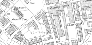 |
| Cartridge Ropery, OS map, 1907. |
Castleton Moor Mill
Cotton
Castleton
1890: Not present on OS map.
1908: Present on OS map.
1956: Marked on OS map as Castleton Moor Mill (wool combing).
1960s: Demolished, became the site of a supermarket.
 |
| Castleton Moor Mill, OS map, 1908. |
Cheesden Lumb Higher
Cotton
Cheesden Brook, Cheesden Lumb
1845: Built as a cotton mill.
1898: Closed after the water rights were sold for the construction of the nearby Ashworth Reservoir.
1982: Archaeology - embanked pond above foundations.
Cotton
Cheesden Brook, Cheesden Lumb
1845: Built as a cotton mill.
1898: Closed after the water rights were sold for the construction of the nearby Ashworth Reservoir.
1982: Archaeology - embanked pond above foundations.
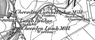 |
| Cheesden mills, OS map, 1848. |
Cheesden Lumb Mill
Woollen
Cheesden Brook, Cheesden Lumb
1786: Built as a woollen mill.
1789: Advertised for sale in the 'Manchester Mercury'.
1809: An advert listed it as as having a perching mill, blueing house, teaster and belonging tenters, and a stove house where sulphur dioxide fumes bleached woollen cloth for blankets. A carding engine was also introduced in this period.
1848: Marked on OS map as Cheesden Lumb Mill (woollen). It was later used as a cotton waste mill, and then the manufacture of lamp wicks.
1898: Closed after the water rights were sold for the construction of the nearby Ashworth Reservoir.
1982: Archaeology - Ruins of three-storey mill with extension across the stream; stone-sided wheel pit.
Cheesden Pasture Mill
Cotton spinning, originally woollen mill.
Cheesden Brook, Cheesden Pasture.
1810: Built by the Ramsbottom family. Initially spun and carded wool for domestic outworkers.
1838: Spinning cotton by this time.
1893: Closed by this time.
 |
| Cheesden Pasture Mills, OS map, 1848. |
Coal Bank Mill
Cotton waste, originally woollen mill, later bleaching
Naden and Old House Brooks
1816: Woollen carding mill.
1832: Cotton waste dealer and flannelette manufacturer also in mill.
1848: Marked on OS map as Cotton Mill.
1879: The part known as Lee Foot Mill was used for bleaching cotton, until WW1.
1891 directory: Richard Bell, Coal Bank Works.
1908: Marked on OS map as Coal Bank Bleach Works.
1916: Mill destroyed by fire.
1928: Marked on OS map as Coal Bank Bleach Works (disused).
1956: Marked on OS map as Coal Bank Bleach Works (disused).
2018: Ruins of mill still present.
 |
| Coal Bank Mill, OS map, 1848. |
Cob House Nab Mill (aka Deeply Vale Print Works)
Dyeing and printing, originally cotton
Cheesden Brook, Deeply Vale
1801: Daniel and Kay established a two-storey cotton-finishing mill here. This was later a printing works with adjoining cottages.
By 1813: The surrounding 30 acres of land contained reservoirs, drying houses, dye houses, stables, and a ‘colour-shop’.
1815: Print works, run by John Brown. Followed by William Heap and Son, who became bankrupt in 1822.
1828: Operated by Heap, Rigby and Raynor. This mill was washed away by the storm-swollen brook, and while it was being rebuilt the new owner, Mr Earnshaw, was killed after he fell into the gearing.
1838: Held leasehold by Samuel Kay from Robert Kershaw, occupied by Price and Doody, who also operated Lower Wheel Works and employed around 200 people. Merged operations with Deeply Vale Mill around this time to form Deeply Vale Print Works.
1890: Marked on OS map as Deeply Vale Paper Works.
1908: Marked on OS map as Deeply Vale Paper Works (disused).
1959: Marked on OS map as Deeply Vale Paper Works (disused).
1968: Building not present on OS map.
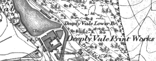 |
| Cob House Nab Mill, OS map, 1848. |
Cocker's Mill
The exact location of this early mill is uncertain, but it was on Bamford Road and might have predated the Moss Mill there. Maps show no other buildings on the road that look like possible sites. The 'Heywood Town Guide' (circa 1950s) records these details:
"This particular undertaking was formerly occupied by one John Turner who kept a grocers shop in Wilton Street about 1842 to 1850. It is curious to remember that a gin-wheel, turned by horses, worked the machinery in this mill."1829 directory: Jonathan Taylor, cotton spinner.
Crimble Mill
Cotton spinning, originally woollen.
Crimble Lane
1780: Originally used as woollen fulling mill.
1826: Sold to Charles Stott, Rochdale cotton spinner.
1829: Rebuilt.
1859: Repurchased by Kenyons.
1871 directory: Crimble Spinning Co., Crimble mill (cotton spinners).
1886: Main section added by Kenyons.
1970: Roe Acre Dyeing purchase mill.
2005: Closure of Roe Acre dyeing company.
2018: Building still present and heritage listed.
 |
| Crimble Mill, OS map, 1930. |
Croston Close Lower (aka Lower Bottoms)
Woollen
Cheesden Brook, Croston
1830s: Open by this time, a woollen mill was owned by George Howarth (brother of John).
1834: It was reported that a 'new mill' here was washed away by flood waters.
1898: Closed after the water rights were sold for the construction of the nearby Ashworth Reservoir.
1982: Archaeology - Remains of the pond but little of the mill itself.
 |
| Croston Close Lower, OS map, 1848. |
Croston Close Upper (aka Middle Bottoms)
Cotton weaving, probably opened as woollen mill
Cheesden Brook, Croston
1810: Open by this time (cotton) was another mill owned by Croston Close farmer John Howarth, and one that was probably established as a woollen mill, spinning and carding wool for the nearby cottage weavers. Most of the workers at these smaller mills in the valley were - like the owners - from the local farms.
1898: Closed after the water rights were sold for the construction of the nearby Ashworth Reservoir.
1982: Archaeology - Stone-built weir, mill pond with overflow, foundations of mill below pond with wheel pit.
 |
| Croston Close Mill, OS map, 1848. |
Cotton spinning, later warehouse
Fox Street
1841 directory: Taylor Edmund, cotton spinner, Dawson hill.
1848: Marked on OS map as Dawson Hill Mill (cotton).
1850 directory: Taylor Edmund, Dawson hill Mill, and Old Brown St., Manchester (cotton spinners).
1871 directory: Mayall Samuel, Dawson hill and Gooden lane mills (cotton spinners).
1891 directory: Dawson Hill Manufacturing Co, Limited, Fox street; 646 looms, twills, drills, sheetings, jacconettes, &c.
1922 directory: Operated by Scott, E.
1937: Marked on OS map as Dawson Hill Mill (cotton)
1956: Marked on OS map as a warehouse.
19??: Used as Boots Warehouse.
2009: Boots Warehouse closed.
2016: Demolished.
 |
| Dawson Hill Mill, OS map, 1829. |
Deeply Vale Print Works (aka Hardman’s Mill)
Dyeing and printing, originally cotton spinning
Cheesden Brook, Deeply Hill
1834: Established, probably as a cotton waste spinning mill. A few years later it was combined with the nearby Cob House Nab Mill to become the Deeply Vale Printing Co.
By 1846: Had two printing machines and 100 handblock tables for making cloths with three, four or five different colours.
1867: Owned by Thomas Hardman and Sons, became known as Hardman's Mill.
1891: Marked on OS map as Deeply Vale Works (disused).
1908: Still present on OS map.
1928: Buildings not present on OS map.
2018: Ruins of mill still present.
 |
| Deeply Vale Print Works, OS map, 1848. |
Derby Mills (aka Darby Mills)
Cotton spinning and manufacturing
William Henry Street, Wham
1871 directory: Todd William and Co., Derby mills (cotton spinner and manufacturer).
1880 directory: Derby Mills Cotton Spinning and Manufacturing Co., Limited, William Henry Street; Wm. Todd, managing director.
1891: Named on OS map as Derby Mill, directly next to site of original Wham Mill.
1891 directory: Derby Mills Cotton Spinning and Manufacturing Co, Limited, William Henry street; 12,000 spindles, 508/608 weft; 780 looms, fine goods.
1922 directory: Operated by Broad, E.
1928: Named on future OS maps as ‘Darby Mills’.
1957: Marked on OS map as Cotton Mill.
1969: Building not present on OS map.
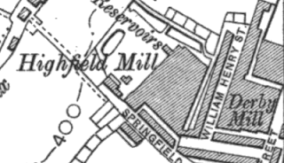 |
| Derby Mill, OS map, 1910. |
Doris Mill (possibly called Charles Town Mills in early years)
Cotton
Bury New Road
1847: Building in this area marked on OS map as Cotton Mill.
1871 directory: Job William and John, Charlestown mills, Bury New road.
1890: Marked on OS map as Cotton Mill (disused).
1907: Marked on OS map as Doris Mill.
1957: Marked on OS map as Cotton Mill.
1969: Marked on OS map as warehouse.
1983: Building present on OS map.
2018: Building no longer present.
Notes: The area between Wham and the Summit used to be known as Charles Town.
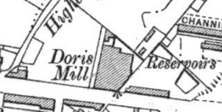 |
| Doris Mill, OS map, 1910. |
Eagle Mill
Cotton spinning
Rochdale Road East
1871 directory: Smith Samuel, Eagle mill (cotton spinners).
1880 directory: Smith Samuel, cotton spinner, Eagle Mill, Rochdale Road; h. 27 York Street.
1888 directory: Smith Samuel, Eagle Mill (cotton spinners).
1957: On OS map as Eagle Steel Works.
1977: Still present on OS map as Eagle Steel Works.
1986: Building not present on OS map.
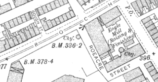 |
| Eagle Mill, OS map, 1907. |
Excel Mill (originally Paved Brow Old Mill, later X.L. Mill)
Cotton spinning, also rubber works
High Street
1829 directory: Chadwick and Diggles, Paved Brow.
1841 directory: Chadwick & Diggles, cotton spinners and fustian manufacturers, Mill St.
1851: The Paved Brow Old Mill is marked in this location on OS map (Paved Brow New Mill is across the street).
1880 directory: Petty & Stott, cotton doublers and manufacturers, Mills Street Mill. It is likely that 'Mills Street Mill' here refers to either Paved Brow Old Mill or Paved Brow New Mill, as they are the only mills on that street at this time.
1890: Marked on OS map as Broadfield Rubber Works, later became Excel Mil. (Paved Brow New Mill is across the street).
1891: New building named on OS map as Broadfield Rubber Works.
1907: Named on OS map as X.L. Mill.
1927: Marked on OS map as Spinning Mill.
1937: Building not present on OS map.
 |
| X.L. Mill, OS map, 1907. |
- Barrett’s 1880 Directory of Bury, Heywood, Ramsbottom, Radcliffe and Pilkington.
- Commercial Directory and Shippers Guide, 1875.
- Hannah Haynes, Heywood, Chalford Publishing, 1997.
- Heap’s 1850 Directory of Bury
- Heywood Advertiser (various dates).
- Heywood Living Memories.
- John Hudson, Heywood in Old Photographs, Sutton Publishing 1994.
- Ordnance Survey maps (various).
- Pigot and Co.’s national commercial directory for 1828-29.
- Pigot and Co.’s Royal National and Commercial Directory of August 1841.
- AV Sandiford and TE Ashworth, The Forgotten Valley, Bury and District Local History Society, 1981.
- Slater’s 1888 Directory of Bury, Heywood, Radcliffe and Ramsbottom.
- Worrall’s 1871 Directory of Bury, Bolton and district.
- Worrall's Cotton Spinners & Manufacturers Directory for Lancashire 1891.
- Worrall’s 1891 Directory of Bury, Bolton and district.
Comments